S2.B7: On a map, locate and identify plate boundaries based on the distribution of volcanoes.
Steps:
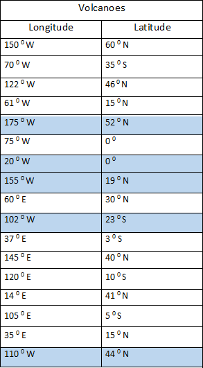
1. Below, you will find a list of volcano coordinates (i.e., longitude and latitude).
2. Split up the list of coordinates between the partners.
3. Use a pencil to mark the location of each volcano on the map. Share the locations with the partners and mark all 17 coordinates on your map.
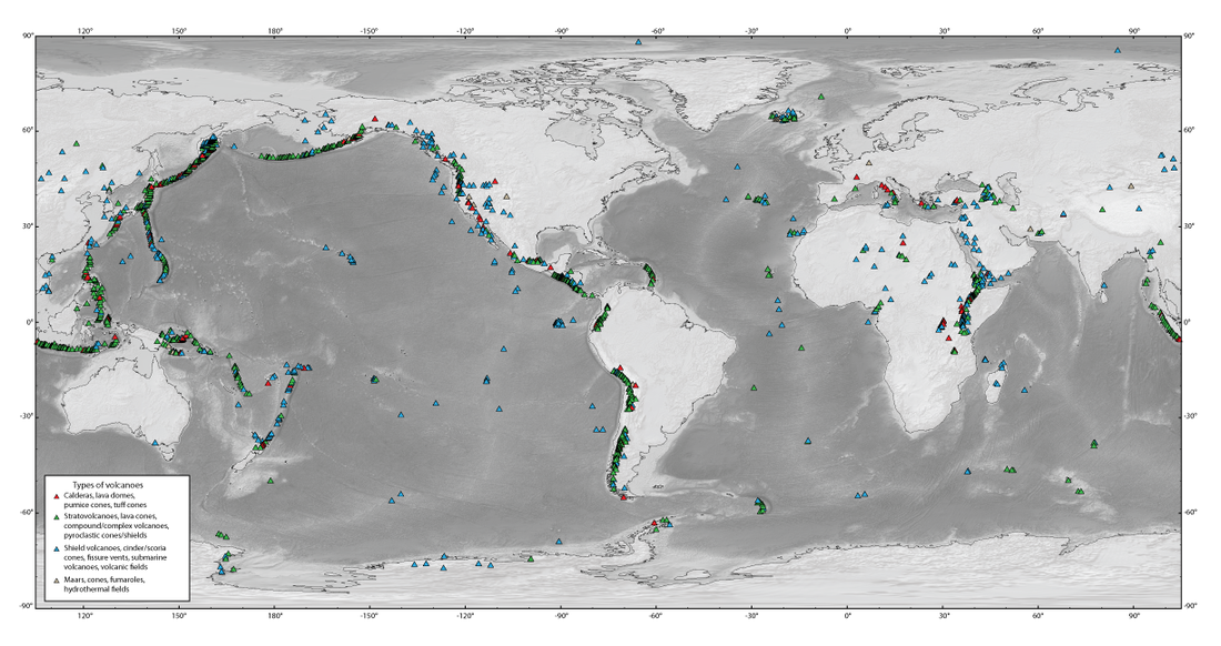
4. Use the Types of Volcanoes: Map to fined clusters of volcanoes (i.e., cluster of stratos).
5. Shade in those areas on your map. Use a different colored pencil for each volcano types
(i.e., green for strato, blue shield, red for cinder cone).
6. Create a KEY on your map.
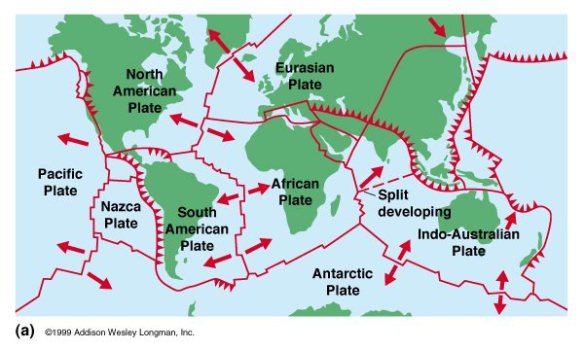
7. Use the Plates Boundaries: Map. Draw the plate boundaries on your map.
8. Use your knowledge of volcanoes and the type of plate boundaries they form at, to label the different plate boundaries (i.e., convergent, divergent, hotspot).
9. Where the volcano and plate boundary comes together, label the tectonic feature associated with that boundary and volcano (i.e., island arc,or volcanic arc,or mid-ocean ridge, or continental rift valley, or hot spot).
10 Answer the question: How are volcanoes distributed? Are they scattered evenly or concentrated in zones?
Types of Volcanoes: Map